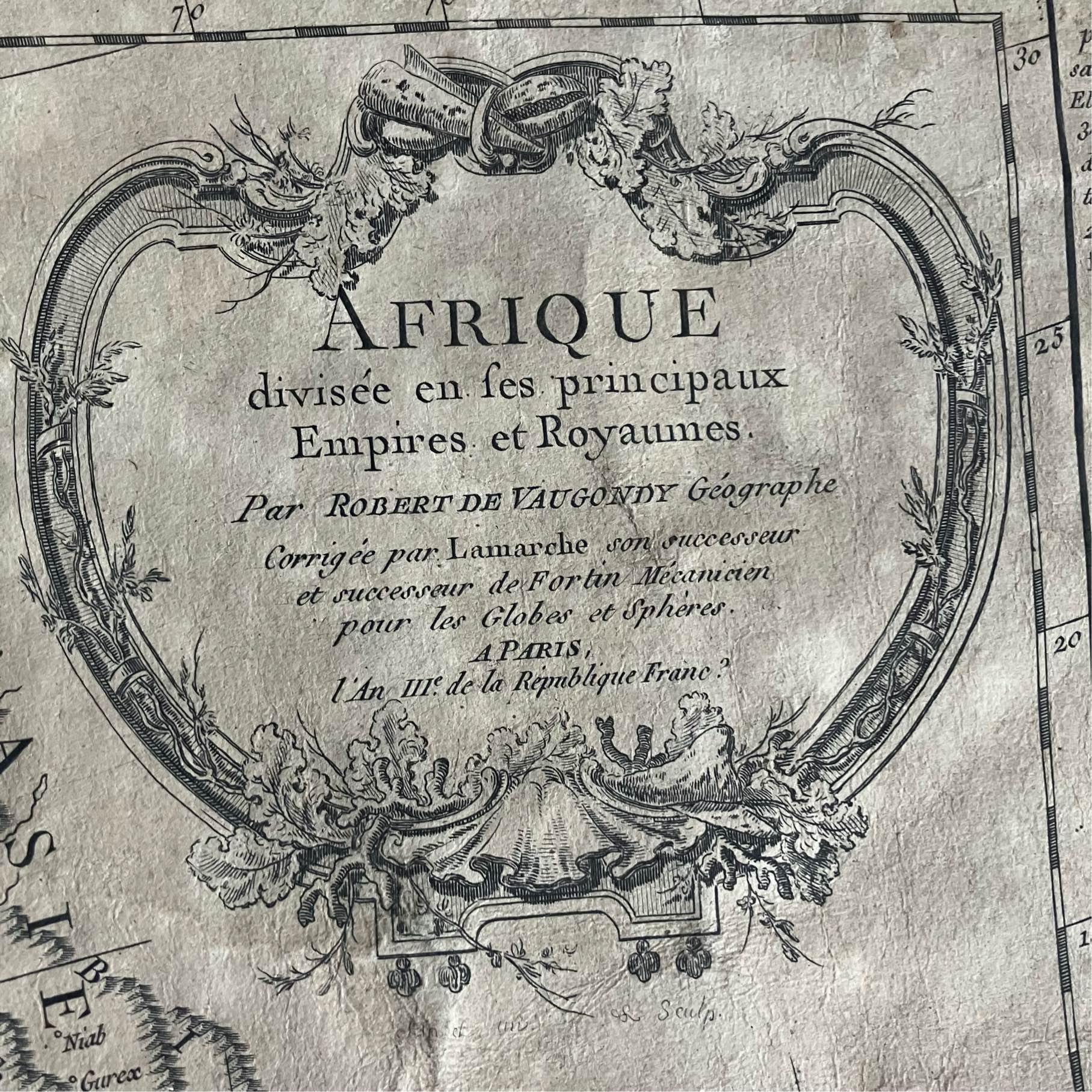
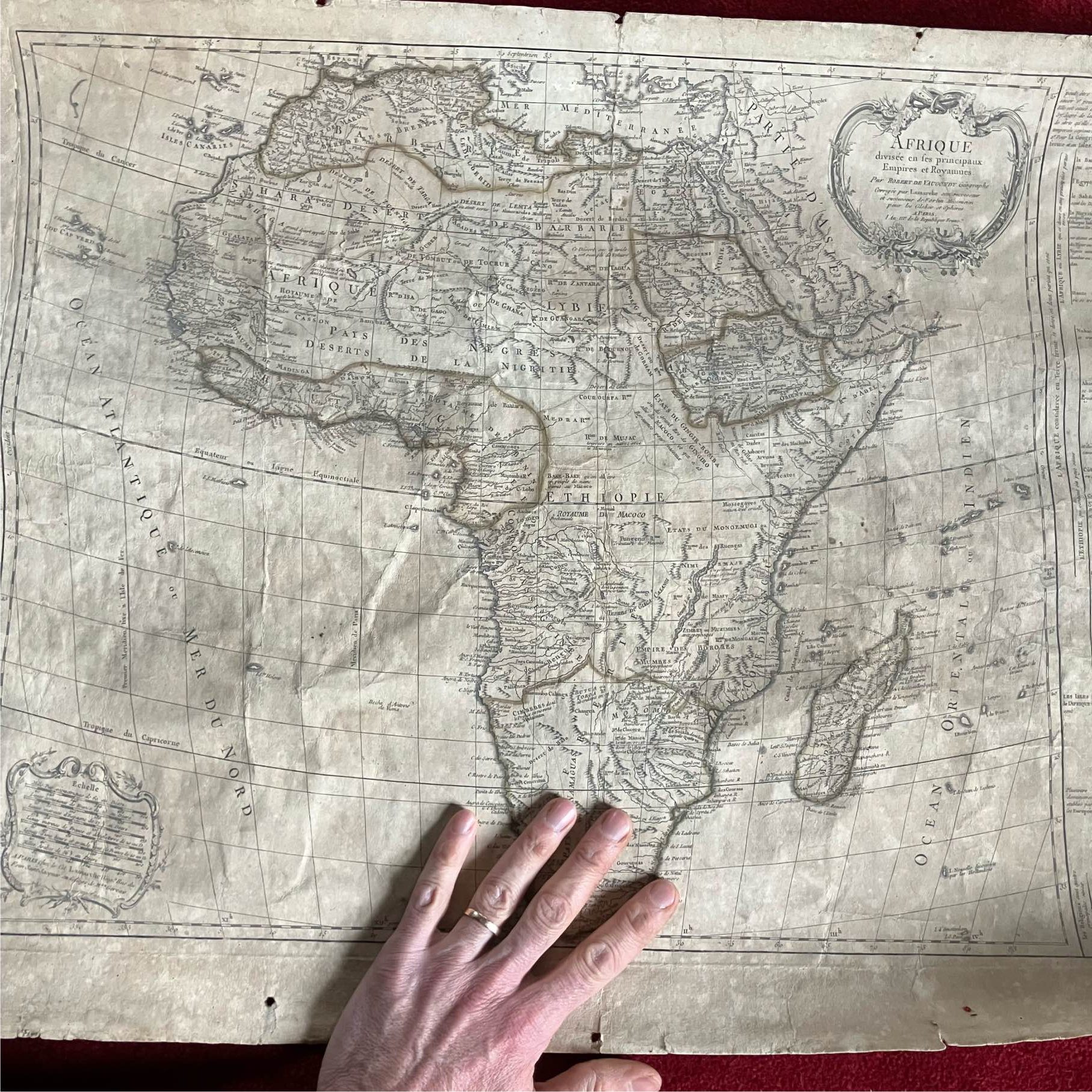
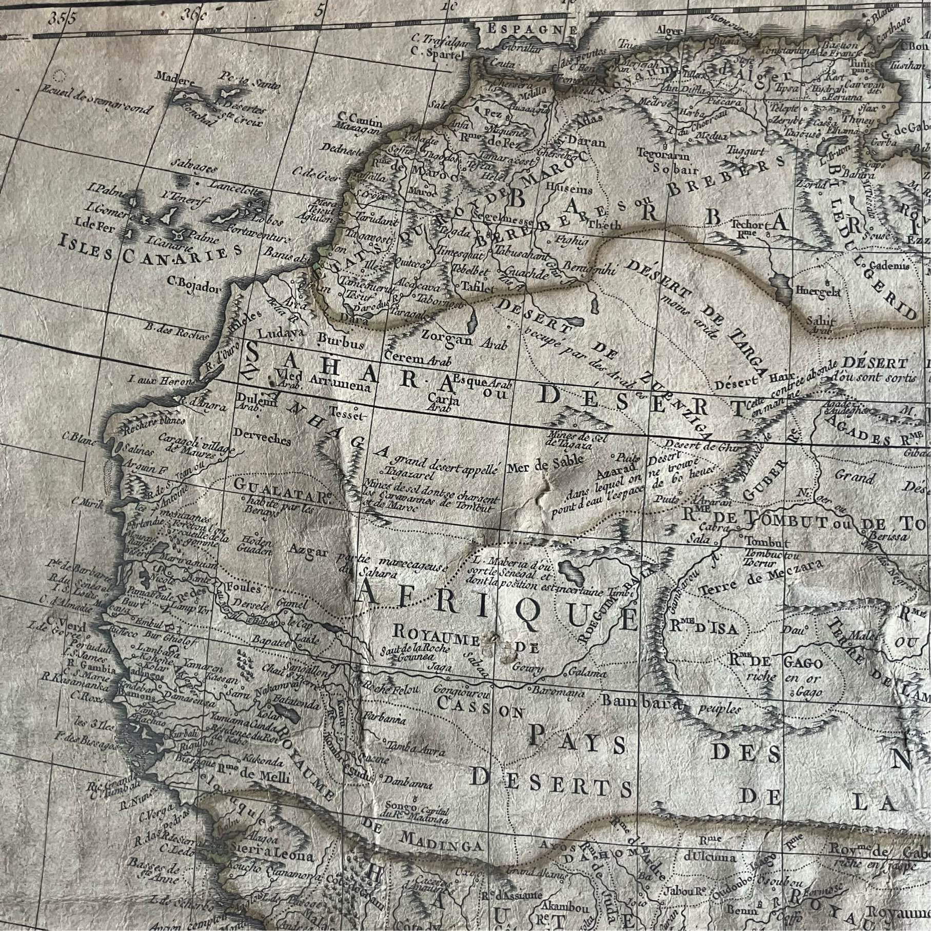
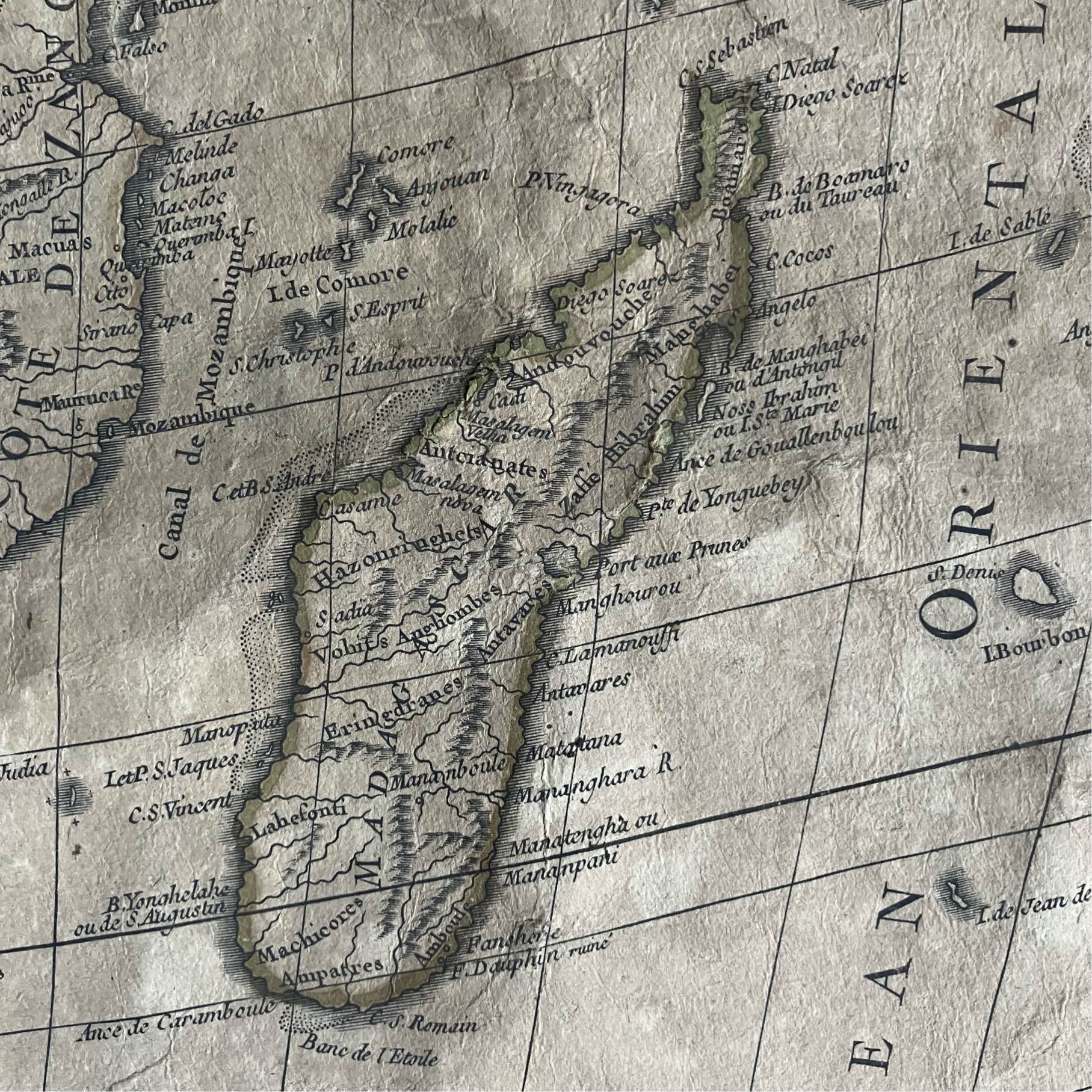
Antique Afrique map by Robert de Vaugondy
€340
Country of manufacture
France
Description
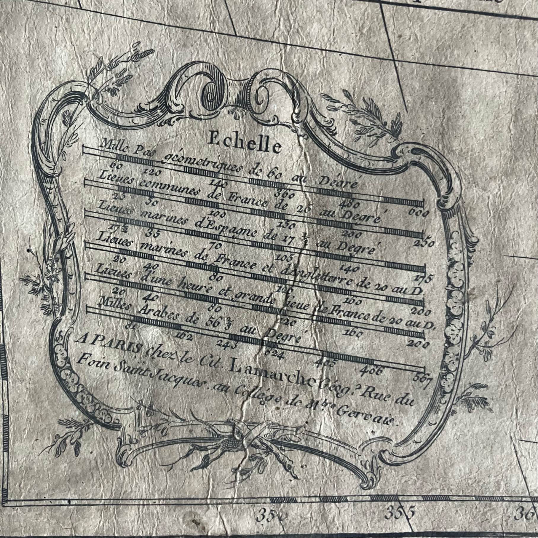
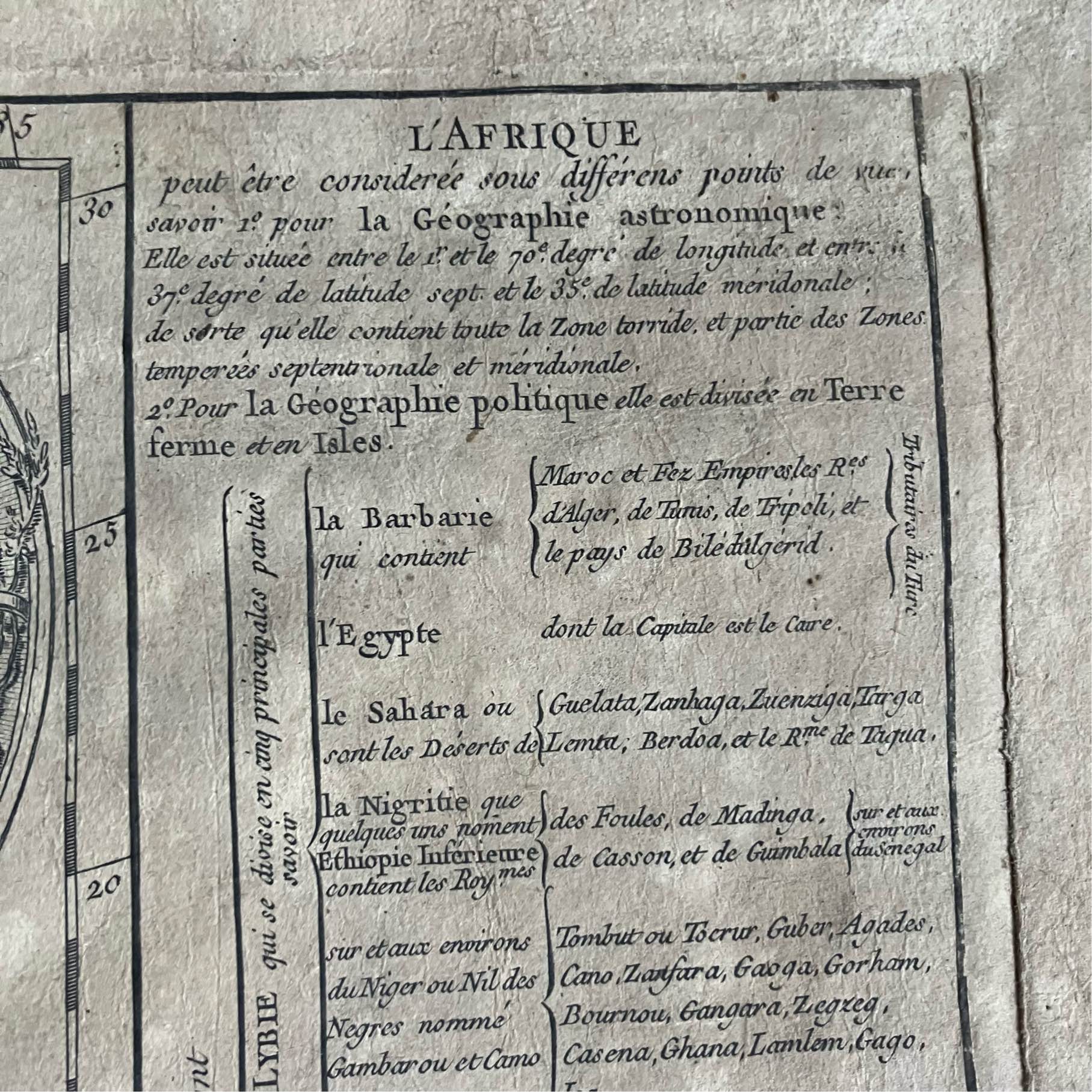
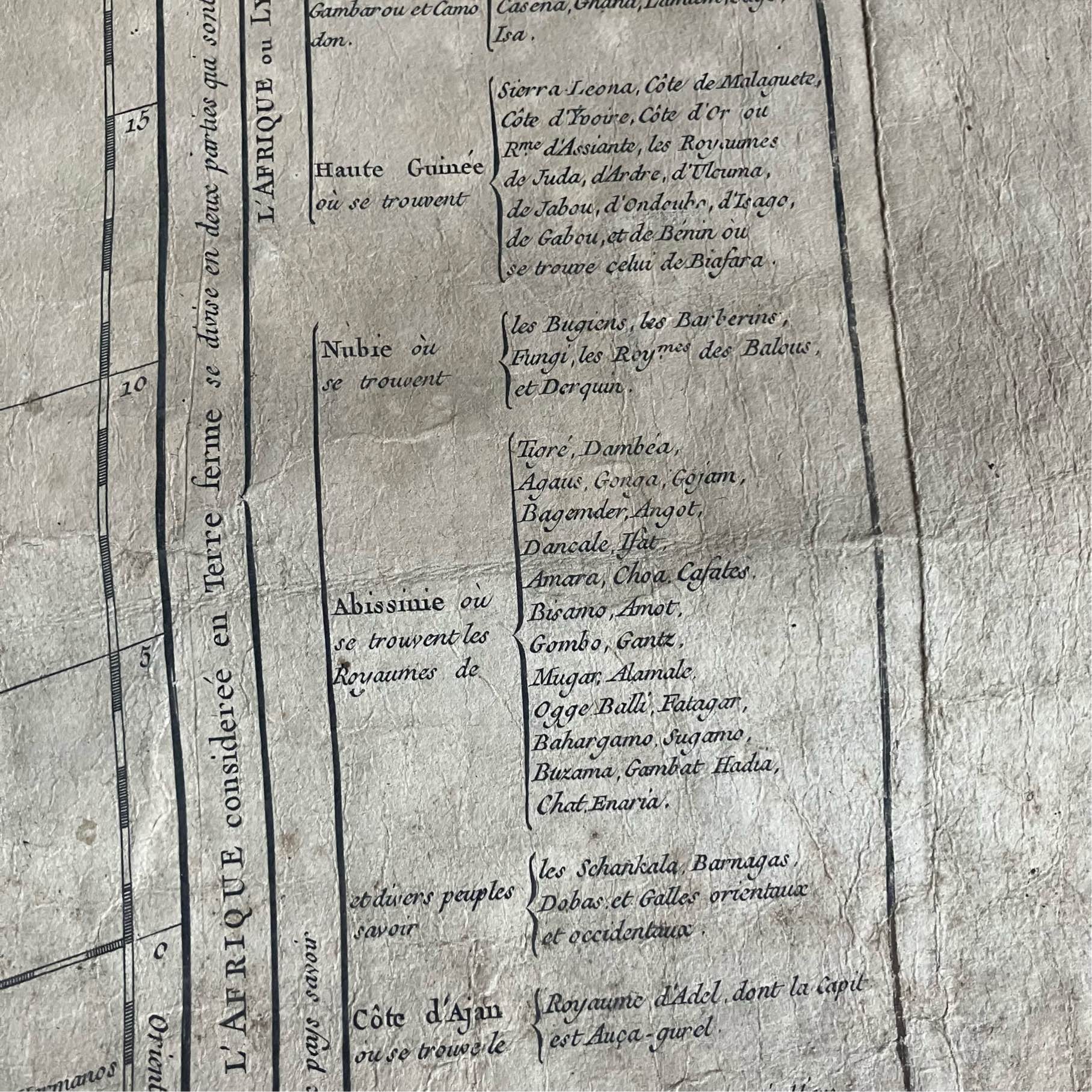
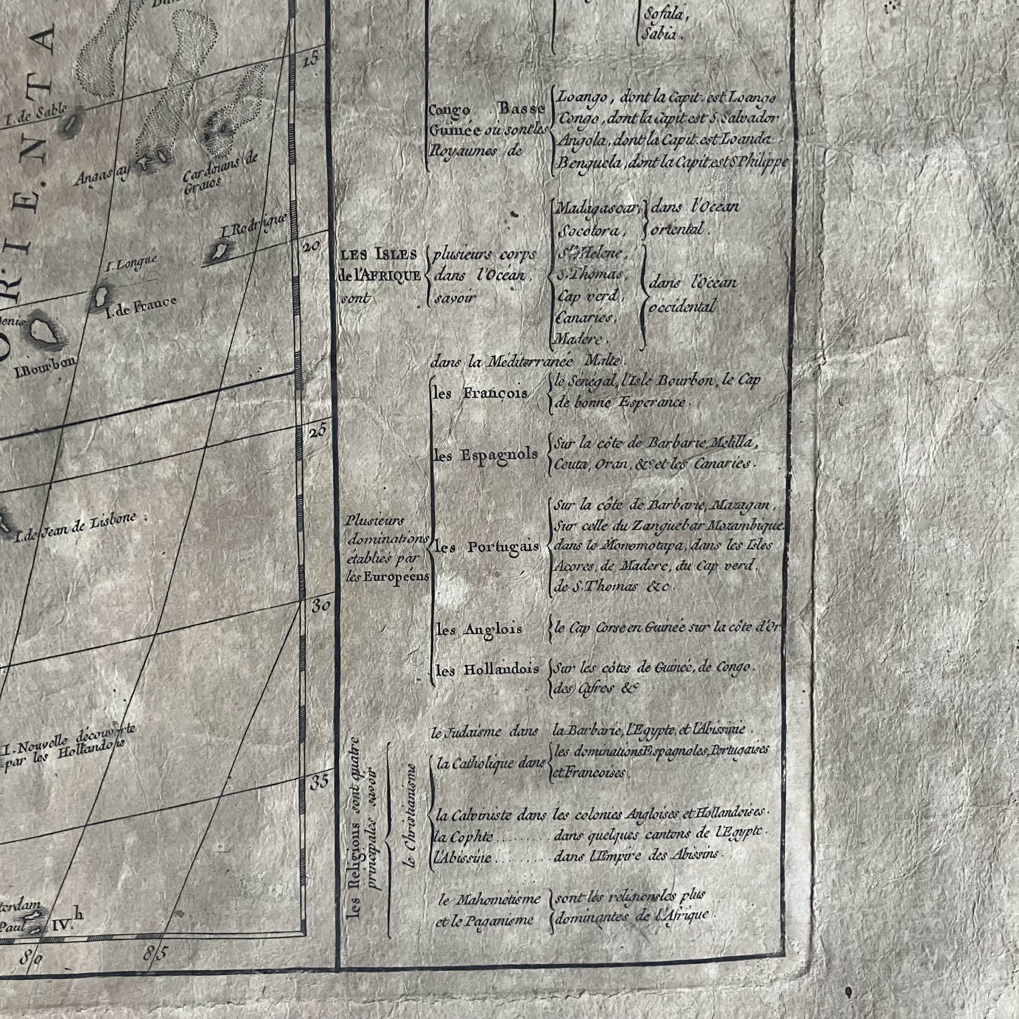
A great antique Afrique map, divided into main empires and kingdoms, by famous French cartographer Didier Robert de Vaugondy (1723-1786), with beautiful and intricate cartouches and hand colouring. Published in the late 1700’s/early 1800’s in Paris.
Size: approximately 76,5 cm x 56,5 cm), copper print map on paper with rear canvas, in good condition despite signs of age
The map is from the “Nouvel Atlas Portatif”, first published in 1762 by Didier Robert de Vaugondy, who was appointed geographer of King Louis XV in 1760 and who intended the atlas to be used to educate young students in the basic elements of geography. The atlas was later published by Charles François Delamarche, a Parisian geographer and publisher who bought the copper plates of Robert de Vaugondy and reissued the atlas.
Ask the Dealer
Dealer information
Nautilus Antiques
Nautilus Antiques
Established in 2005 in Italy, Nautilus tries to be a modern wunderkammer, where antique science and natural history meet, inspiring wonder. I mainly love antique scientific and medical instruments, but my interest extends to unusual or rare technologies and natural history.
Please feel free to contact me by an email (alessandro.molinengo@gmail.com) if you need more information on my listed items. Thanks for your attention and enjoy ! www.nautilusantiques.com